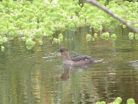
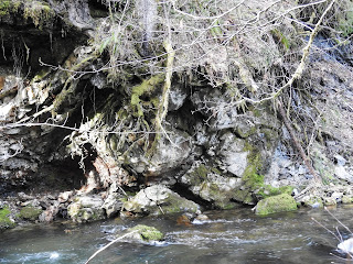
These are photos taken in 2021 to go with my spreadsheet on Dipper and Dipper nest sightings on 6 miles of Agency Creek, starting from our farm and ending at what used to be called Waterhole 11, a bridge at the far end of what is now Big Buck Campground.
Most downstream nest on the 6 miles was Rock Wall, at about mp 1/2 from our farm. It has been unoccupied for several years.
 |
The nest was under overhanging ferns to the left of the waterfall.
|
 |
Just downstream from the rock wall with falls was a rapids where the lookout Dipper kept watch and foraged, singing to alert the nesting bird when I was spotted.
|
Second nest was downstream from The Chutes, about mp 2, an area where the water goes through a narrow rocky canyon. I'll add a photo of that later. Today I took photos of the nest site itself, maybe 1/8 mile downstream from The Chutes.
 |
| Dippers seem to love nesting behind dripping water |
|
Third nest has been under what we call the Railroad Bridge, mp 2.5.
Fourth nest locale is under Sharkey's Bridge, mp 3.5. On my spreadsheet, I have grouped these two bridges together because it seemed there were birds nesting under either one or the other but not both any given year. However they are a mile apart so I could be wrong.
Fifth nest location, at mp 4, is labelled Yoncalla Fire Pit, now just Yoncalla. It is a short distance downstream from the conjunction of Yoncalla Creek and Agency Creek. The nest is under an evergreen that is right on the bank of the road-side branch of Agency. The main branch is on the west side of a large wooded island between the two branches of the creek. The Dippers have been very faithful to this site.


The 6th nest location has changed over the years. It was in a bank on the far side of the creek at what we called "Stump View", m.p. 4.4. The bank collapsed and the Dippers left. A nest reappeared at mp 4.8 across from what we called the Rock Slide, a very steep rocky cliff. The creek there runs through a deep channel with a steep hill on the road side and a steep rocky cliff on the far side, with lots of logs across the creek. I often heard a Dipper singing there but it was several years before we found fledglings and the next year, the nest. So the Rock Slide birds then became the Singing Rock birds. The Singing Rock nest is at mp 4.75 (upstream from its previous location at "Stump View").


The most faithful and easiest to locate nest is just upstream from Asinine Bridge. I will take a photo of that bridge to include here another time. It got that name because it is curved the reverse direction from what the plans called for and from what it should have been. The cliff had to be blasted away after the mistake to let logging trucks make the turn. Or so the legend goes. Milepost 5.5
When we first started this survey, the nest was in the cliff across from the road. But the cliff was unstable and the birds had to move... to beneath the roots of a streamside tree. It is quite visible across the creek from a pull-off alongside the road. Although it takes good binocs or camera or a good imagination to see the mossy nest below the trunk. My camera made it visible.
The last nest before the road leaves Agency Creek is at what used to be called Waterhole 11 at mp 6.5. It is under the bridge that crosses Agency at the end of what is now called Big Buck Campground. From Yoncalla Creek onward is territory owned by the Confederated Tribes of Grand Ronde. The portion before that where Agency Creek Rd. takes off from Grand Ronde Rd. is owned and managed by Hampton Timber company.
The birds that nested at the Waterhole 11 bridge were very faithful until the campground became popular and full of people and dogs. We have not found nesting there for several years. However Covid has closed the campground temporarily and Dippers are in the area again. Perhaps they had found another nesting site farther upstream away from the human congestion.


